KAS Software
Suppliers of map viewing and coordinate conversion software, bespoke digital maps, height data and gazetteers
KAS Software
Suppliers of map viewing and coordinate conversion software, bespoke digital maps, height data and gazetteers

All files here are free for download for personal use only. Under no circumstances may you redistribute or sell any of these files or executable programs without the express written permission of KAS Software Ltd. By downloading any of these files you are implicitly agreeing to these restrictions.
For all map and gazetteer downloads - with the exception of the MapView installation executable - right click in your browser over the desired link, then select the 'Save Link As...' option. (Although the map and gazetteer files appear to be text files, they have binary data appended to them.)
N.B. Requires DirectX 9, downloadable from the Microsoft Download Centre website. (For LOD maps to work, your graphics card must support L16 textures. Intel® HD Graphics 3000 cards, for example, support this mode.)
Download the following, all derived from OS OpenData sources, for a quick start-up:
OS OpenDataTM sourced maps, these all contain Ordnance Survey data, © Crown copyright and database right 2011 & 2014. To find out what the Ordnance Survey permits you to do with OS OpenDataTM see the OS OpenData Licence.
OS OpenDataTM sourced gazetteers, these contain Ordnance Survey data © Crown copyright and database right 2011. (Codepoint® gazetteer contains Royal Mail data © Royal Mail copyright and database right 2010 & contains National Statistics data © Crown copyright and database right 2010 - see OS OpenData Licence):
Other gazetteers, without any copyright restrictions:
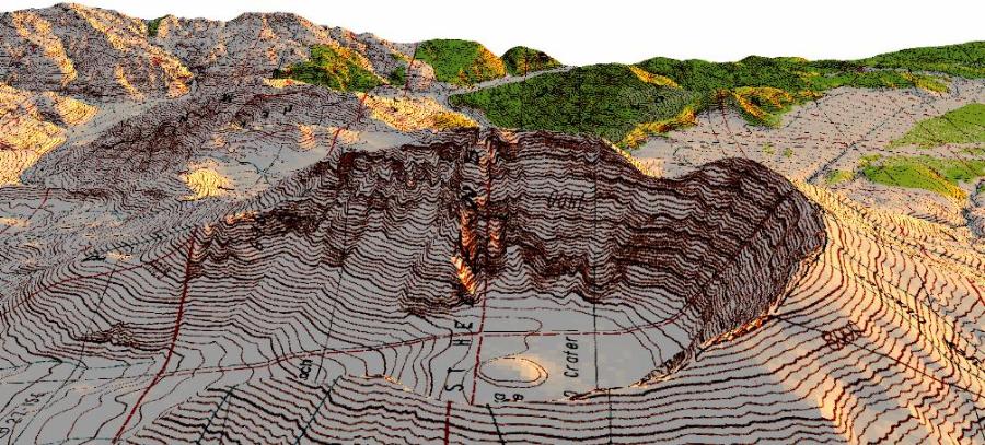
You can download masses of USGS Geotiff quads for free from various sites on the internet, such as this GeoTiff file of Old Faithful, Yellowstone, this GeoTiff showing Kilauea Crater, Hawaii, or this one for Phantom Ranch, Grand Canyon, Arizona. (For a comprehensive list of available USGS resources, have a peek at the links page.) There are approximately another 50,000 1:24,000 scale USGS Geotiffs available, a couple of thousand 1:100,000 scale geotiffs and a few hundred 1:250,000 scale files - not to mention files from other mapping agencies worldwide - all can (hopefully) be viewed within MapView.
We've prepared a number of composite maps, in gdf file format, from these free GeoTiffs. Samples of these, at 1:24,000 scale unless otherwise indicated, may be accessed as follows:
There's also free USGS NED 1" & 2" elevation data, again in gdf file format, to cover most of the above areas:
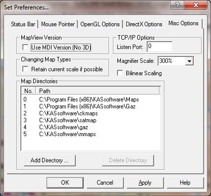
Once downloaded copy the relevant map, height or gazetteer files(s) to a directory of your choice, then use the Settings->Set Preferences menu option, click on the 'Misc Options' tab, then click 'Add Directory...' to add this directory to MapView's working list. Restart MapView and your map(s) will be listed. Be aware that the selected directories and all their sub-directories will be searched for map files the next time MapView starts up.
A variety of sample gpx format files created by MapView. These may be freely copied or redistributed.
The MapView program and associated getting-started files are packaged in a self-extracting zip file which requires little more than being double-clicked upon to start the installation program.
The program comes with a downloadable comprehensive help which should ensure trouble-free use. Further online help is available here.